GIS SERVICES

Effective business services
GIS Services
As a leading business service in the GIS domain, TheContractum
offers geospatial and IT services to worldwide customers. The company also partners and
collaborates with various GIS Companies to come up with innovative solutions to complex
geospatial requirements to complete the task in the active field.
- Global Geospatial Expertise
- Collaborative Innovation
Geofencing Services
Geofencing services enable businesses to create virtual boundaries and
monitor activities within a defined area. Our solutions help in real-time tracking,
sending instant alerts, and optimizing operations to enhance productivity and security.
Features & Benefits
- Monitor assets, vehicles, or personnel with accurate real-time location updates
- Define specific geographic boundaries to track entry and exit events
- Get immediate alerts when an object or person enters or leaves a geofenced area
- Optimize routes, reduce delays, and enhance decision-making
- Detect unauthorized movements and improve safety protocols
- Access historical movement data for performance analysis and auditing
Utility Rights of way Mapping Services

Our Utility Rights of Way (ROW) Mapping Services help utility companies,
municipalities, and infrastructure providers map, analyze, and manage the pathways used
for pipelines, transmission lines, and other utilities. This ensures proper planning,
compliance, and minimizes conflicts during construction and maintenance.
Features & Benefits
- High-precision mapping of pipelines, transmission lines, and utility corridors
- Ensure adherence to government regulations and safety standards
- Detect encroachments and avoid disputes during construction
- Reduce project costs and time with efficient path planning
- Seamless integration with enterprise GIS for better asset management
- Generate detailed ROW maps and documentation for audits and records
Lidar Data Processing Services

Our LiDAR Data Processing Services transform raw LiDAR data into accurate,
actionable information. We deliver high-quality terrain models, 3D maps, and feature
extraction to support infrastructure development, urban planning, and environmental
studies.
Features & Benefits
- Convert raw LiDAR data into precise digital elevation and surface models
- Create detailed 3D maps for urban planning, utilities, and infrastructure projects
- Identify and classify features like buildings, vegetation, and utilities
- Ensure accurate, reliable, and usable datasets
- Seamlessly integrate processed data with enterprise GIS systems
- Ideal for flood modeling, route planning, mining, forestry, and more
Geofencing Services

Geofencing services enable businesses to create virtual boundaries and monitor
activities within a defined area. Our solutions help in real-time tracking, sending
instant alerts, and optimizing operations to enhance productivity and security.
Features & Benefits
- Monitor assets, vehicles, or personnel with accurate real-time location updates.
- Define specific geographic boundaries to track entry and exit events.
- Get immediate alerts when an object or person enters or leaves a geofenced area.
- Optimize routes, reduce delays, and enhance decision-making.
- Detect unauthorized movements and improve safety protocols.
- Access historical movement data for performance analysis and auditing.
Pole Loading Analysis
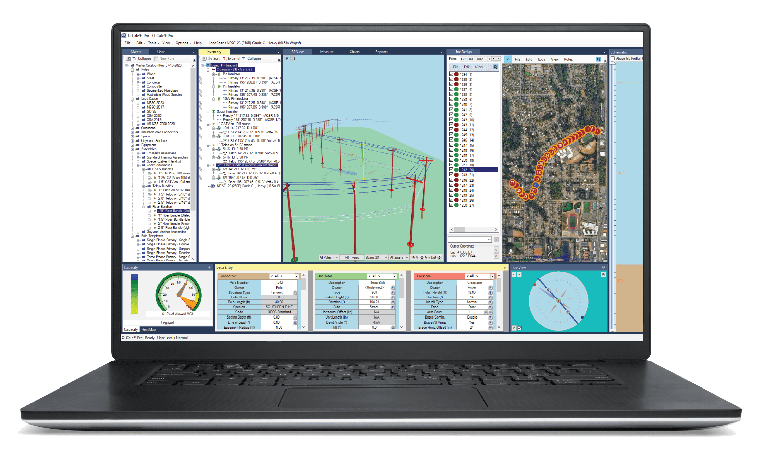
Our Pole Loading Analysis Services ensure the structural integrity and safety of utility
poles under different load conditions. We analyze existing pole infrastructure to
determine whether it can support current and future loads such as power lines, telecom
equipment, and additional attachments.
Features & Benefits
- Evaluate the strength and capacity of utility poles under multiple load scenarios.
- Identify overloaded or unsafe poles to prevent failures and outages.
- Support compliance with industry standards and safety regulations.
- Provide recommendations for pole replacement, reinforcement, or redesign.
- Help optimize infrastructure planning for future equipment installations.
- Deliver detailed reports for maintenance and asset management decisions.
GIS Data Capture
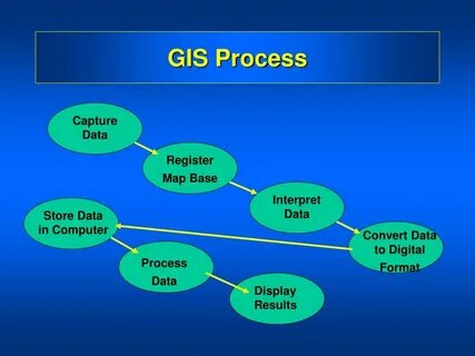
Our GIS Data Capture Services help organizations collect, digitize, and manage accurate
geospatial data from multiple sources. We ensure high-quality data that forms the
foundation for effective GIS analysis, planning, and decision-making.
Features & Benefits
- Collect and digitize geospatial data from satellite imagery, field surveys, and existing maps.
- Ensure high positional accuracy and attribute consistency for reliable results.
- Standardize and validate data to meet project-specific requirements.
- Integrate captured data with GIS systems for seamless analysis and visualization.
- Support multiple industries including utilities, telecom, transport, and urban planning.
- Deliver comprehensive datasets that improve operational efficiency and decision-making.
Parcel Mapping
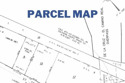
Our Parcel Mapping Services help in creating accurate digital maps of land parcels,
enabling better property management, tax assessment, and land use planning. We ensure
clear visualization of boundaries and attributes for efficient decision-making.
Features & Benefits
- Create precise digital maps of land parcels with clear boundaries.
- Support property tax assessment and land ownership verification.
- Enable better planning for zoning, development, and infrastructure projects.
- Integrate parcel data with GIS systems for advanced analysis and reporting.
- Improve efficiency for municipalities, real estate, and land management agencies.
- Provide easy-to-understand visual representation of parcel information.
Topographical Mapping
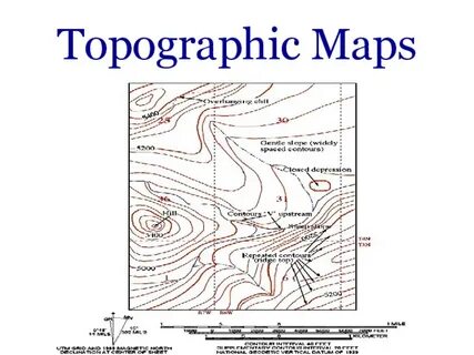
Our Topographical Mapping Services deliver detailed and accurate maps representing the
natural and man-made features of the terrain. These maps are essential for construction
projects, infrastructure planning, environmental studies, and land development.
Features & Benefits
- Accurately capture terrain elevation, contours, and surface features.
- Support construction, engineering, and infrastructure development projects.
- Provide a clear understanding of slopes, drainage, and natural obstacles.
- Enable better planning for roads, utilities, and site layouts.
- Integrate with GIS systems for advanced spatial analysis.
- Reduce risks and improve decision-making in project execution.
Cadastral Mapping
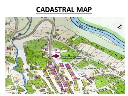
Our Cadastral Mapping Services provide accurate representation of land parcels,
ownership boundaries, and property details. These maps are crucial for land
administration, property disputes resolution, taxation, and urban planning.
Features & Benefits
- Precisely map property boundaries and ownership details.
- Support legal documentation and land registration processes.
- Assist in resolving land disputes with accurate data.
- Enable efficient property tax assessment and collection.
- Enhance urban planning and development projects.
- Integrate seamlessly with GIS for spatial analysis and decision-making.
Municipal Mapping

Our Municipal Mapping Services help city planners and local authorities manage
infrastructure, utilities, and public services more efficiently. These maps enable
better decision-making, urban planning, and smart city development.
Features & Benefits
- Map roads, utilities, and municipal assets accurately.
- Support smart city planning and infrastructure upgrades.
- Enable efficient waste management and public service delivery.
- Assist in zoning, building permits, and urban development.
- Enhance disaster preparedness and emergency response planning.
- Provide data for citizen engagement and transparency initiatives.
Land Survey Services

Our Land Survey Services deliver precise measurements and mapping for property
boundaries, construction projects, and infrastructure planning. We ensure accuracy and
compliance with legal standards for smooth project execution.
Features & Benefits
- Accurate measurement of property lines and boundaries.
- Support construction, real estate, and land development projects.
- Ensure compliance with legal and regulatory requirements.
- Provide data for topographic and cadastral mapping.
- Assist in infrastructure planning and site layout design.
- Minimize disputes through reliable and precise survey results.
Property Services

Our Property Services help clients manage, evaluate, and optimize their real estate
assets. From property valuation to legal documentation support, we provide end-to-end
solutions to ensure smooth transactions and effective property management.
Features & Benefits
- Accurate property valuation and assessment services.
- Support for buying, selling, and leasing properties.
- Assist with legal documentation and registration processes.
- Provide detailed cadastral and boundary mapping.
- Enable better decision-making for property investments.
- Offer consultancy for land development and urban planning projects.
DGPS Survey

Our DGPS (Differential Global Positioning System) Survey Services provide highly
accurate location data for land, infrastructure, and utility projects. Using advanced
equipment, we deliver centimeter-level precision for critical surveying tasks.
Features & Benefits
- Centimeter-level accuracy in location data collection.
- Ideal for infrastructure, construction, and land development projects.
- Supports cadastral, topographical, and alignment surveys.
- Enhances planning and decision-making with precise geospatial data.
- Minimizes errors and reduces project risks significantly.
- Seamlessly integrates with GIS and CAD systems.
POI (Point of Interest)

Our POI (Point of Interest) Mapping Services identify and map important locations such
as businesses, landmarks, and infrastructure points. These services are essential for
navigation systems, urban planning, and location-based solutions.
Features & Benefits
- Identify and categorize key landmarks and locations.
- Support navigation apps, GIS databases, and LBS solutions.
- Enhance urban planning and tourism development.
- Provide accurate location data for business analysis.
- Enable better route planning and decision-making.
- Improve customer engagement through location-based services.
PA-POI (Property Address)

Our PA-POI (Property Address) Mapping Services identify and map property addresses and
related details for residential, commercial, and industrial properties. These services
are essential for real estate management, property analysis, and urban development
planning.
Features & Benefits
- Accurately identify and record property addresses.
- Support real estate databases and property management systems.
- Enhance urban planning and infrastructure development.
- Provide precise location data for property analysis.
- Enable better route planning for deliveries and services.
- Improve customer engagement through address-based services.

Subscribe Us To Recieve Career Updates
Banking at Your Fingertips
$500 from free Commercial Bank
No products in cart.
Popular Suggestions


Choose Options
RTL Version
- RTL Version
- LTR Version
Boxed Version
- Boxed
- Full width
Want Sticky Header
- No
- Yes